8 Accra flood-prone areas to avoid during heavy rains
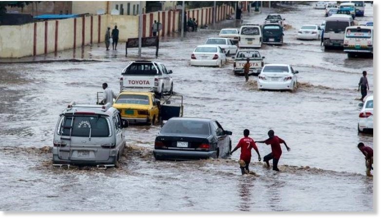
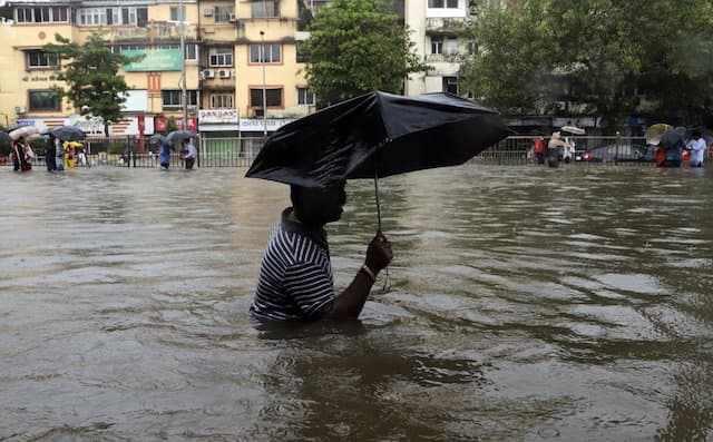
Accra's rainy season brings more than just relief from the heat—for thousands of residents, it signals weeks of anxiety, waterlogged roads, submerged homes, and genuine danger. With the Ghana Meteorological Service forecasting more heavy rainfall in the coming days following floods that have already claimed four lives and displaced families across the capital, knowing which areas carry the highest risk could save your life.
Rapid urbanization, poor drainage infrastructure, and unregulated construction have made Accra increasingly vulnerable to flooding year after year. The rainy season typically runs from April to July, with a second peak in October—and parts of the city are already feeling the strain.
Here are eight Accra communities particularly susceptible to flooding where residents and motorists should exercise extreme caution.
1. Ofankor
Situated along the N1 Highway, Ofankor is among Accra's most flood-prone stretches. The Ofankor Barrier area becomes heavily inundated during sustained downpours, bringing traffic to a standstill and stranding pedestrians. In June 2023, flash floods submerged vehicles and caused widespread disruption along the corridor.
2. Weija
Weija's location near the Weija Dam and the Densu River makes it uniquely vulnerable, particularly when dam spillages occur. The 2022 spillage submerged numerous homes and properties, displacing many residents. While dredging exercises have been carried out to ease the situation, the threat remains during peak rainfall periods.
3. Kasoa
Straddling the boundary of Greater Accra and the Central Region, Kasoa floods quickly — even after relatively short spells of rain. Rapid urbanization and chronically poor drainage leave roads inundated and traffic gridlocked whenever heavy rain strikes, disrupting commerce and daily movement across the area.
4. Kwame Nkrumah Circle (Circle)
One of Accra's busiest transport hubs, Circle has a long and well-documented history of severe flooding. Its low-lying terrain and inadequate drainage cause water to accumulate rapidly, paralysing traffic and trade. The area gained tragic notoriety in June 2015, when floodwaters contributed to a fuel station explosion that claimed dozens of lives.
5. East Legon Hills
East Legon Hills, one of Accra's fastest-growing residential areas, has seen a sharp rise in flooding incidents in recent years. Just two weeks ago, residents reported flooded homes and leaking roofs following heavy downpours. Unregulated development and insufficient drainage infrastructure continue to leave properties and roads exposed whenever rainfall is sustained.
READ MORE: Ghana Weather Forecast: Rain and thunderstorms expected - June 7
6. Pantang
Located along the Accra-Aburi road, Pantang's low-lying terrain and rapid urban growth without matching infrastructure investment make it a recurring flooding hotspot. Heavy rains regularly leave roads waterlogged and transportation through the area severely disrupted.
7. Akweteyman
Akweteyman has emerged as one of Accra's increasingly vulnerable flood communities. Residents frequently contend with overflowing drains, waterlogged roads, and disrupted movement during periods of heavy or sustained rainfall.
8. Kaneshie
Kaneshie, one of Accra's major commercial and transport centers, is highly susceptible to flooding during the rainy season. The area's dense activity, aging drainage infrastructure, and low-lying sections along key roads mean that heavy rainfall quickly overwhelms the drainage network, leaving roads impassable and disrupting the busy market and transport operations that thousands of Accra residents depend on daily.
Edem Kwame
Edem Kwame is a journalist at GH News Media covering news and national developments in Ghana.